Mobile, Desktop and Web-Based Mapping Systems
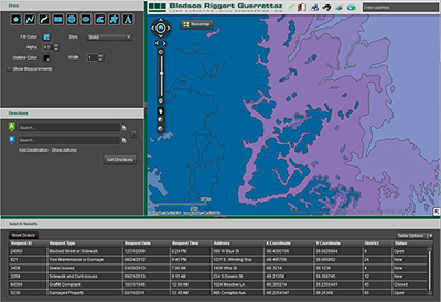
Whether you need a simple, public-facing mapping app, or a robust, secure, enterprise-level spatial planning application, we can develop a solution for you. Our web-based mapping systems allow visualization and analysis of data to
promote effective decision making at all levels of the organization. Our systems can integrate data from any number of sources and provide clear, clean, easy to use mapping interfaces that present information more effectively and
efficiently. In our development processes, we can utilize a number of technologies to best fit your needs. These include cutting edge programming APIs, cloud-based architecture, and innovative security practices. Our web-based
systems are fully secure, giving you precise and total control over who has access to the information. Some potential applications of these systems include: asset and facilities management, site location, routing and network analysis,
vehicle tracking, market analysis, work order tracking, and natural resource management, among many others.
Cartography
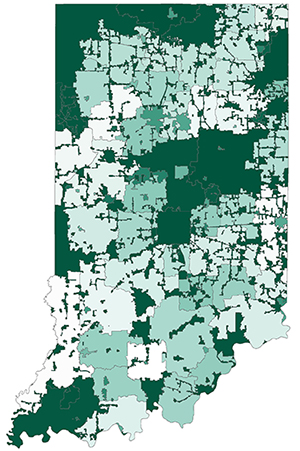
We are specialists in producing beautiful, easy to use maps and graphics for print and display in any size or format. Our cartographic expertise is employed on all of our products, including web-mapping interfaces, print maps, and
graphics. In addition to interactive web mapping applications, we can create a number of static cartographic products: anything from a poster sized printed map to an image for a website. We can also produce maps designed for special
purposes, such as color blind-friendly, or projector-ready.
Data Maintenance, Collection and Creation
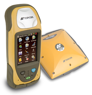
The cornerstone of effective IT systems is good data. Whatever your data needs, we can find a solution. If you need data to bring into your system, we can help. Originally founded as a surveying firm, we are able to leverage our professional
land surveying crews to collect data and find assets. This highly accurate information gives the systems we design an unprecedented level of spatial precision. If you already have data, but things aren't working quite right, let
us help. We can process, analyze, convert and clean existing data.
Business and Systems Analysis
Want to get started with GIS but don't know how or where to begin? We offer a number of system and business analysis consultation services, such as needs assessments and cost benefit analyses (including return on investment calculations).
Whether you need advice on implementing a new system or measuring the effectiveness of an existing system, we can give you a professional, impartial, and evidence-based consultation.
Project Management
We can manage any GIS or IT project you want to undertake. We can provide you with a number of management services including coordination, scheduling, reporting, documentation and even staffing. Whatever your project, we're eager to
partner with you to make it a better experience.
Integration with Existing Systems
While our custom built systems are highly effective, we can further empower your organization by integrating legacy data into your newer systems. Our integration services include data extraction, conversion, transformation, and loading
to integrate with the systems we build, or with any other system you have currently or are planning. By integrating more data within the same system, we make effective decision-making easier and more informed.